
Manchester ZIP Code Directory Coverage
Manchester’s postal geography overlaps several labels. The strongest local association is 08759, yet nearby postal designations can touch a Manchester address or show a neighboring city. The state crosswalk and USPS materials support different parts of the picture, so the table distinguishes a verified overlap from an unresolved allocation. It does not convert a postal designation into a legal township line.
| ZIP | Areas or postal designation found | Post office | Research note |
|---|---|---|---|
| 08759 | Manchester Township designation and the Manchester/Whiting service area | USPS Whiting, 108 Lacey Rd Ste 38, Whiting | USPS DMM and the NJ DOBI crosswalk support the Manchester/Whiting association. |
| 08757 | Toms River postal city with a small part of Manchester Township | Toms River postal system | The NJ DOBI crosswalk expressly identifies the small Manchester overlap. |
| 08733 | Lakehurst postal city and an adjacent or NAEC-area postal cluster | USPS Lakehurst, 1 Brown Ave, Lakehurst | The captured sources do not define an exact Manchester municipal allocation. |
| 08758 | Waretown/Ocean Township designation in the state crosswalk | Postal table groups it with the Manchester designation | Mark as boundary-unresolved, not township-wide coverage. |
The Whiting station is listed at 108 Lacey Road, Suite 38, Whiting, NJ 08759-9998, with weekday and Saturday counter hours in the research record. Its address and hours are a postal-service contact, not a definition of the whole Manchester municipal footprint.
Manchester ZIP Labels and Jurisdiction
Manchester Township was formed in 1865 and has a spread-out Ocean County footprint. Its official street map uses place and development names such as Whiting, Pine Lake Park, Crestwood, Cedar Glen, Lake Ridge, and Pine Ridge. Those names help a person recognize an area, but they do not replace the municipal field on a tax record. Postal city, situs address, legal description, and municipal boundary can all carry different information.
The New Jersey DOBI crosswalk is the clearest local mismatch source: it says 08757 includes a small part of Manchester Township, while 08759 is associated with Manchester Township, Lakehurst, Manchester, and Whiting. The USPS DMM postal table groups 08733 and 08758 through 08759 under a Manchester Township postal-designator row. That row is for postal addressing, not a survey of municipal lines.
Verify Manchester ZIPs With USPS
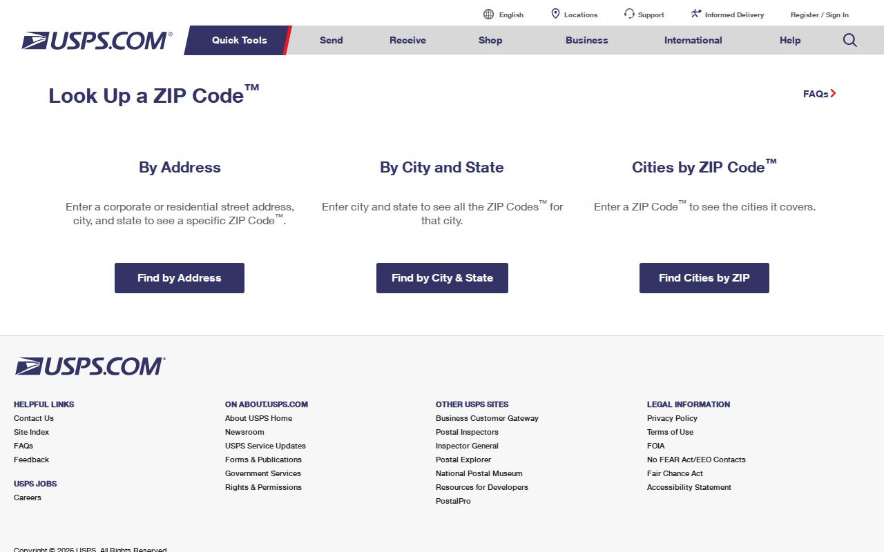
USPS is the first check for a present mailing address. Its lookup has By Address, By City & State, and Cities by ZIP tabs. The By Address form uses an optional Company field, required Street Address, optional Apt/Suite/Other, required City and State, optional ZIP, and Find. Save the standardized result alongside the original spelling from a deed, newspaper, directory, or tax card rather than overwriting historical wording.
See the live controls at the USPS ZIP Code Lookup.
USPS warns that a standardized result does not confirm a person or company at the address and cannot guarantee a business location. It is a postal-normalization result, not a resident list.
Search Manchester Permits by ZIP
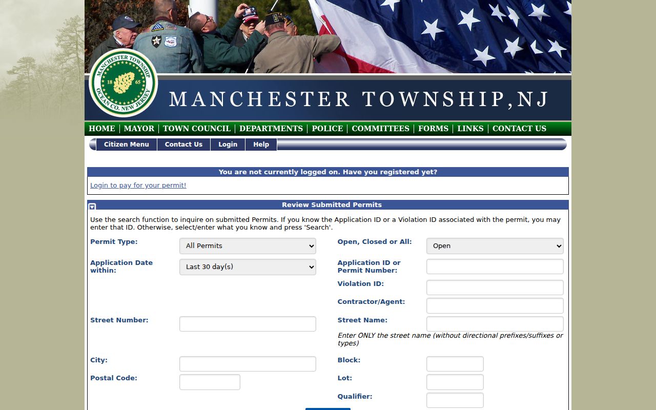
Manchester FastTrackGov is the local public tool that clearly includes a Postal Code field. Its permit and land-use search also accepts application date, status, application ID, violation, contractor or agent, street number and name, city, block, lot, and qualifier. Start with the ZIP only as a narrowing field. Add street or parcel information before deciding that a returned municipal application relates to the intended location.
| FastTrackGov field | ZIP-focused use |
|---|---|
| Postal Code | Narrows public permit matches by postal address. |
| Street number and name | Confirms the precise address inside a shared ZIP. |
| City | Tests the portal’s address wording alongside the municipal context. |
| Block, lot, qualifier | Connects the permit result to the Ocean County parcel key. |
| Date, status, ID, violation | Limits the result to an administrative event and time period. |
The Manchester FastTrackGov ZIP-capable permit search shows the municipal search route.
A returned permit can document an application, status, address, and related agent or contractor. It does not establish a postal census or current occupancy.
Find Manchester Records by ZIP
Within one Manchester ZIP, use the postal result to refine the address, then move to systems that can establish property or municipal context. The county tax page does not expose a ZIP field on its first search screen. Its useful fields are municipality, block, lot, qualifier, property class, and property location. County GIS can identify an address or parcel, but it does not advertise a ZIP-wide result. This is why the final check belongs to the parcel and municipality rather than a broad postal result.
- Normalize the address through USPS and retain the returned ZIP and city line.
- Compare the city line with the NJ DOBI crosswalk when the address is near 08757, 08733, or 08758.
- Search Ocean County tax records by Manchester municipality plus location or block and lot, then verify the situs and mailing fields in parcel detail.
- Use county GIS to identify the parcel and municipal boundary, then match the block, lot, and map information.
- Use FastTrackGov Postal Code with the street or legal parcel fields for a public permit lead, not a resident roll.
Once the ZIP narrows a location to a road and parcel, the Manchester street directory gives the fuller address-keyed sequence.
Voter data needs a separate route. The state registration check is designed for an individual’s status and locality, while the live field layout was not captured in the research. It is not a public ZIP list. A defined Ocean County voter-file request requires a signed OPRA form sent by fax or mail, and a comprehensive list also requires the Election Order form. The county normally allows 7 to 10 working days, with possible election-cycle delay. Signatures, Social Security numbers, driver or non-driver identifiers, and protected addresses are withheld. Treat a lawful voter response as a limited registration record, not proof that every person in a postal area lives at an address.
Manchester Tax and GIS ZIP Limits
Ocean County Tax Board records can give a current assessed owner, property location, mailing field, block/lot, class, values, sale clues, and building details. The County GIS layers can show parcels, municipal boundaries, tax maps, zoning, flood, wetlands, easements, rights-of-way, and building footprints. Neither source is a ZIP directory search. The tax site is address and parcel keyed, while GIS identifies a location within a maintained map dataset.
On a tax detail, keep the property location and the mailing address as separate fields. A mailing address can be outside Manchester or belong to an owner, representative, estate, or organization. The situs is the field that anchors the parcel, while the municipal and block/lot fields test whether a postal result belongs in the township record set.
Parcel polygons are not surveys or legal boundaries, and Daniel’s Law can remove owner names from some hosted parcel or tax applications. A blank field is not proof that a parcel has no owner. Compare a map result with the County tax detail and, where relevant, a SearchNG document instead of treating any one display as a complete answer.
Note: The research did not locate a public Ocean County tax export, a ZIP-wide GIS result, or a live voter-search field set for postal filtering.
Manchester ZIP Directory Terms
Postal terms describe delivery patterns. They should be recorded separately from the Ocean County parcel keys that identify a Manchester property.
- ZIP
- A Postal Service routing designation used with an address; it does not by itself establish a municipal boundary.
- ZIP+4
- An added four-digit delivery segment that refines a ZIP for a more specific route or address range.
- PO-box ZIP
- A designation used for post-office boxes; it should not be treated as the physical situs of a parcel.
- Unique ZIP
- A ZIP assigned for a particular organization or high-volume destination, distinct from a general residential route.
- Carrier route
- A mail-delivery grouping that can cross local descriptions and does not function as a municipal map.
Manchester ZIP Labels Across History
Historic records retain the label used at the time. Manchester’s 1865 creation, Whiting’s 1861 name, and Lakehurst’s 1921 separation can all affect an older location heading. A 1905 to 2011 newspaper entry, a directory publication, or a deed can use a place label that differs from a current USPS response. Preserve the old spelling, source date, city wording, and any original ZIP, then compare it with the present parcel only as a later research step.
For a pre-digital address trail, the Ocean County Library Wheeler Room offers old directories, phonebooks, maps, atlases, yearbooks, and newspapers. Its catalog records city-directory and microform holdings, though the research did not verify an exact Manchester publication run. The State Archives holds county deed microfilm through 1900, and FamilySearch’s New Jersey wills and deeds collection can supply a discovery lead. The Ocean County Historical Society can search local archival material remotely for a fee or assist on site. Use the original publication or document image to preserve the postal wording it actually carried.
No official ZIP split or realignment year, historic boundary timeline, ZIP population count, or exact Manchester allocation for 08733 and 08758 was verified. That gap matters. Do not invent a precise line from a current postal lookup when the record being studied predates the current arrangement.
Manchester ZIP Labels and City Limits
A Manchester postal directory helps sort ZIP labels, but it cannot prove who lives at an address or replace the township boundary. The 08757 overlap is expressly described as a small part of Manchester Township. The 08759 association is strong. The 08733 and 08758 connections need a boundary caveat because the captured official material does not map an exact township share. Verify each address with USPS, tax municipality, GIS, and the relevant recorded or municipal source.